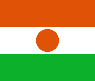
Niger
Republic of the Niger
Population: UN WPP 2024, revision 1, projection for 1 July 2026. Sources and methodology.
Geography and territory
Niger is a landlocked nation at the heart of West Africa, covering 1,267,000 square kilometers that make it the sixth-largest country on the continent. Its vast territory stretches from the depths of the Sahara Desert in the north down through the Sahel transition zone to more humid savanna in the south, a gradient that defines the country’s geography and climate alike. More than 80 percent of Niger’s land area is desert, making it one of the most arid nations on Earth.
The Niger River, from which the country takes its name, cuts through the southwestern corner of the territory for roughly 550 kilometers, forming a vital corridor of fertility that sustains agriculture and daily life for millions. Lake Chad, shared with Nigeria, Chad, and Cameroon, touches the country’s southeastern edge, though its surface area has shrunk dramatically in recent decades due to climate change and heavy water use. In the north, the Air Mountains rise abruptly out of the desert, culminating at 2,022 meters at Mount Idoukal-n-Taghes, the country’s highest point.
Niger’s climate ranks among the hottest on the planet, with desert-zone temperatures regularly exceeding 45 degrees Celsius during the warmest months. Rainfall is confined to a brief wet season between June and September and drops off sharply moving from south to north. The Tenere Desert in the northeast counts among the most inhospitable regions on Earth, a vast expanse of sand and rock where daytime temperatures can top 50 degrees Celsius and rain is virtually nonexistent. Home to roughly 28.8 million people, Niger combines this harsh environment with one of the fastest-growing populations of any country in the world.
History
Human presence in what is now Niger dates back to prehistoric times, as evidenced by petroglyphs and rock paintings found in the Air Mountains and the Tenere Desert depicting hunting scenes, wildlife, and daily life from an era when the Sahara was a fertile savanna. Dinosaur remains unearthed near Agadez, including the Nigersaurus and Suchomimus, have established Niger as a paleontological site of genuine global importance.
Successive civilizations and kingdoms flourished across Nigerien territory over the centuries, capitalizing on its position along the trans-Saharan trade routes. The Sultanate of Agadez, founded in the fifteenth century by the Tuareg, controlled the trade in salt, gold, and enslaved people between sub-Saharan and North Africa. The Songhai Empire, centered on Gao in present-day Mali, extended its reach into western Niger during the sixteenth century, while Hausa kingdoms in the south, centered on cities like Zinder and Maradi, built prosperous urban economies grounded in trade and craftsmanship.
French colonization, established in the late nineteenth century following stiff resistance from local populations, folded the territory into French West Africa. Niger achieved independence on August 3, 1960, under the presidency of Hamani Diori. Its postcolonial history has since been marked by periods of military rule, devastating droughts, Tuareg rebellions in the north, and, more recently, security challenges linked to armed groups operating across the wider Sahel region, all of which have weighed heavily on national stability.
Culture and society
Nigerien society encompasses a rich diversity of peoples, prominently including the Hausa, Zarma-Songhai, Tuareg, Fulani, Kanuri, and Toubou. Each group brings distinct traditions, languages, dress, and forms of social organization, creating a cultural mosaic of considerable depth. The Hausa, the largest group, are known for their commercial traditions and historic cities, while the Tuareg, desert nomads, have preserved a way of life bound to the Sahara for millennia.
The Tuareg, sometimes called the “blue men of the desert” for the indigo dye that stains their skin from their traditional turbans, maintain a captivating culture that includes Tifinagh, one of the oldest writing systems still in use anywhere. Their matrilineal social structure, skilled leatherwork and silver craftsmanship, and deep knowledge of desert survival have made them cultural icons well beyond Niger’s borders. The Cure Salee Festival, held annually in Ingall, draws thousands of nomadic herders and ranks among the most spectacular gatherings in Africa.
Nigerien craftsmanship is celebrated throughout West Africa, with centuries-old traditions in Tuareg silver and leather jewelry, indigo fabric dyeing, pottery, and leatherwork. Traditional music, performed on instruments such as the tende drum, the single-stringed molo, and the Hausa algaita oboe, accompanies weddings, celebrations, and ceremonies. The Gerewol, a male beauty pageant held by the Wodaabe Fulani in which young men apply elaborate makeup to compete for the attention of women, stands as one of the continent’s most distinctive cultural traditions.
Economy
Niger’s economy of about $21.6 billion relies heavily on subsistence agriculture and livestock herding, which together employ more than 80 percent of the working population. Principal crops include millet, sorghum, rice, and beans, grown mainly in the southern strip of the country where rainfall permits cultivation. Agriculture remains severely constrained, however, by scarce rainfall, soil degradation, and advancing desertification, conditions that trigger recurring food crises affecting millions.
Uranium mining has historically been the country’s leading source of export revenue. Niger ranks among the world’s top uranium producers, with mines at Arlit and Akokan in the north operated by the French company Orano, formerly Areva. Falling global uranium prices and political tensions have, however, reduced the sector’s contribution to national income in recent years. The discovery of oil deposits in the Agadem region and the construction of a refinery at Zinder have opened new economic possibilities.
Livestock herding, practiced by both nomadic and settled communities, forms another economic pillar, with cattle, sheep, and goats exported to neighboring countries. Informal cross-border trade, especially with Nigeria, plays a significant role in the real economy. Despite these resources, Niger consistently ranks near the bottom of global human development indices, grappling with structural challenges including one of the world’s highest birth rates, inadequate infrastructure, and mounting demographic pressure on limited natural resources.
Food and cuisine
Nigerien cuisine centers on the cereal grains that form the backbone of most people’s diet. Millet stands as the essential grain, prepared in numerous ways: as tuwo, a thick porridge served with various sauces; as fura, small balls of ground millet mixed with soured milk and sugar; or fermented into dolo, a traditional millet beer. Sorghum and rice supplement the grain-based diet, particularly in areas near the Niger River.
The sauces served alongside tuwo represent the true art of Nigerien cooking, with variations including baobab leaf sauce, okra sauce, peanut sauce, and miyan kuka, made from powdered dried baobab leaves. Lamb, goat, and beef are commonly grilled or prepared as kilichi, strips of dried and spiced meat that serve as the country’s most popular snack and an ideal food for long journeys across the desert thanks to its long shelf life.
Green tea, prepared in the Saharan style across three successive rounds of increasing sweetness, functions as the essential social beverage in Niger, particularly among Tuareg and Hausa communities in the north. Fresh and fermented cow’s and goat’s milk play a fundamental nutritional role, especially for pastoral communities. Taguela, a Tuareg bread baked by burying dough beneath hot coals and desert sand, ranks among the most distinctive culinary preparations in Africa and stands as a testament to human adaptation to the harsh conditions of the Sahara.
Tourism and landmarks
The Air Mountains and the Tenere Desert, jointly designated a UNESCO Natural World Heritage Site, form Niger’s most spectacular travel destination. The Air massif, a volcanic range rising dramatically above the surrounding desert, shelters palm oases, hot springs, and wildlife adapted to extreme conditions, including Barbary sheep and dama gazelles. Prehistoric petroglyphs carved into the rock bear witness to an era when this region was fertile and densely populated.
The city of Agadez, gateway to the desert and the historic Tuareg capital, captivates visitors with its mudbrick architecture, including the Great Mosque in the Sudano-Sahelian style, whose 27-meter minaret dominates the skyline and ranks among West Africa’s architectural icons. Agadez’s old town is inscribed on the UNESCO World Heritage List, and its market, where Tuareg traders sell silver jewelry, embossed leather, and ceremonial swords, offers an immersive cultural experience.
W National Park, shared with Benin and Burkina Faso, stands as one of the last strongholds of wildlife in the Sahel, recognized as both a World Heritage Site and a Biosphere Reserve. Its gallery forests along the Niger River shelter elephants, hippopotamuses, lions, cheetahs, and an exceptional variety of birdlife. Niamey, the capital, offers the Grand Market, the National Museum of Niger with its zoo and crafts village, and bridges spanning the Niger River that provide memorable sunset views over the water.
Fun facts about Niger
- Niger has one of the highest birth rates in the world, causing its population to double roughly every generation
- The Tree of Tenere was for decades considered the most isolated tree on Earth, standing more than 400 kilometers from its nearest neighbor until a truck struck it down in 1973
- The Gerewol festival of the Wodaabe Fulani is one of the few male beauty pageants in the world, where men apply elaborate makeup to attract women
- Fossil remains of the unique dinosaur Nigersaurus, a plant-eater with hundreds of teeth in its jaw, were discovered in the Tenere Desert
- Niger and neighboring Nigeria both take their names from the Niger River, whose name likely derives from a Tuareg phrase meaning “flowing waters”
- Agadez was historically known as the gateway to the desert, the starting point for salt caravans that crossed the Sahara to the mines of Bilma
Niger in numbers
Latest World Bank and UNDP observations, each with its own year. “World median” is the middle value among the countries that report the same indicator; “#” ranks from the highest value.
Population since 1960
Niger had 3.5 million people in 1960 and 27.9 million in 2025 — 8.0 times as many.
People
18.4% of people live in towns and cities (world median 63.4%). 46.2% are under 15 and 2.6% are 65 or older — a very young population. Women have 5.93 children on average, above the replacement level of about 2.1.
Economy
The economy grew by 7.0% in real terms in 2025. Consumer prices fell by 4.5% in 2025. Agriculture makes up the largest share of output (47.6% of GDP); agriculture contributes 47.6%, a large share that points to a farming-based economy.
Development and environment
UNDP rates human development in Niger as low, with an index of 0.419 in 2023 (rank 188 of 193). 15.6% of people use the internet and 21.3% have access to electricity. Forest covers 0.8% of the land (world median 32.8%).
Sources: World Bank, World Development Indicators (CC BY 4.0), most recent observation from 2015 onward; UNDP Human Development Report 2025. Retrieved 2026-10-10. Sector shares need not add up to 100% because taxes and subsidies on products are excluded. Missing values are left blank rather than estimated. Sources and methodology.
Climate of Niger
Averaged across Niger, the warmest month is June (33.7 °C) and the coolest is January (19.3 °C), a seasonal swing of 14.4 °C. The annual mean is 28.0 °C.
About 181 mm of precipitation falls in a typical year. August is the wettest month (73 mm) and January the driest (0 mm). What little rain there is falls mostly from July to September (82% of the total).
Less than 250 mm a year is typical of desert climates.
Show monthly values as a table
| Month | Mean °C | Low °C | High °C | Precipitation, mm |
|---|---|---|---|---|
| January | 19.3 | 11.5 | 27.1 | 0 |
| February | 22.3 | 14.3 | 30.4 | 0 |
| March | 26.9 | 19.0 | 34.9 | 0 |
| April | 31.4 | 23.3 | 39.5 | 2 |
| May | 33.6 | 26.0 | 41.2 | 7 |
| June | 33.7 | 26.6 | 40.8 | 19 |
| July | 32.1 | 25.9 | 38.4 | 49 |
| August | 31.0 | 24.9 | 37.2 | 73 |
| September | 31.3 | 24.3 | 38.4 | 26 |
| October | 29.3 | 21.6 | 37.1 | 4 |
| November | 24.7 | 16.6 | 32.9 | 0 |
| December | 20.4 | 12.6 | 28.3 | 0 |
Figures are 1991–2020 averages across the whole land area of Niger, from the World Bank Climate Change Knowledge Portal, CRU TS 4.08 (CC BY 4.0). They are not readings from one weather station: the capital, the coast and high ground can be much warmer, cooler, wetter or drier.
Travel essentials for Niger
The practical details visitors ask about first. Traffic in Niger drives on the right, like most of the world. Mains electricity is 220 V at 50 Hz, so devices made only for 110–120 V (common in North America) need a converter unless they are dual-voltage — most phone and laptop chargers are.
- Emergency number
- 17Fire 18
- Driving side
- Right
- Plug types
- Type A, Type B, Type C, Type D, Type E, Type FA: two flat parallel pins; B: two flat pins plus a round earth pin; C: two round pins (Europlug); D: three large round pins in a triangle; E: two round pins, earth pin in the socket; F: two round pins with side earth clips (Schuko)
- Voltage
- 220 V50 Hz
- Dialling code
- +227From abroad: your exit code, then 227 and the number
- Currency
- West African CFA Franc (XOF)
- Time zone
- WAT (UTC+1)Current local time in Niger
Compiled from IEC plug and voltage standards, national emergency-service listings and the UN road-traffic conventions. Emergency numbers and local coverage can change — confirm them locally on arrival. Niger's internet domain is .ne.
Where Niger ranks in the world
Each position counts only the countries with data in that ranking guide. First place is the highest value — for price levels, the most expensive. Select a card to see the full table.
- Population53rd of 19628.8 millionUN projection, July 2026
- Land area20th of 1951,266,700 km²World Bank, 2023
- Population density163rd of 19421 per km²World Bank, 2023
- GDP (nominal)126th of 187$19.7BWorld Bank, 2024, current US$
- GDP per capita179th of 187$730World Bank, 2024, current US$
- Life expectancy184th of 19461.4 yearsWorld Bank, 2024
- Price level117th of 16538 (US = 100)ICP 2021, household consumption
Bordering countries of Niger


Compare Niger with another country
Frequently asked questions about Niger
What is the capital of Niger?
The capital of Niger is Niamey.
What is the population of Niger?
The UN World Population Prospects projection for Niger is 28,814,878 people (28.8 million) on 1 July 2026. National statistical offices may publish different estimates.
What language is spoken in Niger?
The official language of Niger is French.
What currency is used in Niger?
The currency of Niger is the West African CFA Franc (XOF).
How big is Niger?
Niger covers an area of 1,267,000 km².
What type of government does Niger have?
Niger is a semi-presidential republic.
Which countries border Niger?
Niger shares land borders with Algeria, Libya, Chad, Nigeria, Benin, Burkina Faso, Mali.
What is the highest point in Niger?
The highest point in Niger is Mount Idoukal-n-Taghes (2,022 m).


