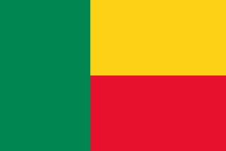
Benin
Republic of Benin
Population: UN WPP 2024, revision 1, projection for 1 July 2026. Sources and methodology.
Geography and territory
Benin is a narrow, wedge-shaped country in West Africa that stretches from the Gulf of Guinea in the south to the Niger River in the north, covering a total area of 112,622 square kilometers. Its coastline runs for barely 121 kilometers, yet the territory fans out steadily as it moves inland, giving the country its distinctive elongated silhouette on the map. The south is dominated by low-lying coastal plains, lagoons, and mangrove swamps, most notably around Lake Nokoué near the port city of Cotonou.
Central Benin rises into a plateau of fertile land and rolling hills, cloaked in wooded savanna and patches of tropical forest that support a rich variety of wildlife. Further north, the terrain climbs gently toward the Atakora mountain range, home to the country’s highest point, Mount Sokbaro, which reaches 658 meters. The Ouémé, Mono, and Alibori rivers form the backbone of the national water system, sustaining agriculture and fishing communities across the country.
Benin’s climate shifts noticeably from south to north. The coastal south enjoys an equatorial climate with two rainy seasons and two dry seasons, while the north experiences a single, more pronounced rainy season typical of tropical savanna zones. This climatic range supports strikingly different ecosystems, from the humid forests near the coast to the dry savanna of the interior, linked by narrow strips of gallery forest along the rivers. Pendjari National Park and the transboundary W National Park, shared with Niger and Burkina Faso, protect some of the region’s most important wildlife habitats.
History
Benin’s history is inseparable from the powerful Kingdom of Dahomey, which dominated the region from the seventeenth century until French colonization. Founded by the Fon people, Dahomey became one of the most highly organized states in West Africa, fielding an army that famously included the Dahomey Amazons, an all-female regiment whose skill and discipline astonished European visitors. The kingdom grew wealthy largely through trade with European slavers, and the port of Ouidah became one of the principal points of departure for the transatlantic slave trade.
French colonization began in the second half of the nineteenth century and was fully secured after the defeat of King Béhanzin in 1894. The territory, renamed Dahomey, was absorbed into French West Africa and administered as a colony until independence was declared on August 1, 1960. The following decades were marked by considerable political instability, with a succession of coups culminating in the installation of a Marxist-Leninist regime under Mathieu Kérékou in 1972.
In 1990, Benin became a continental model by carrying out one of Africa’s first peaceful democratic transitions. The National Conference of the Living Forces of the Nation achieved a bloodless political transformation, adopting a multiparty constitution and holding free elections. Known as the Renouveau Démocratique, this process has been studied and admired across Africa as an example of consensual, nonviolent political change, and it laid the groundwork for the stable constitutional order Benin maintains today.
Culture and society
Benin is widely regarded as the birthplace of Vodun, an ancestral religion that originated in this region long before enslaved people carried it to the Americas. Far removed from cinematic stereotypes, Vodun is a complex spiritual system that honors ancestors and the forces of nature through ritual, dance, and offering. Every January, the city of Ouidah hosts the International Vodun Festival, a vibrant ceremony that draws devotees and curious visitors from around the world and that has been recognized as a national holiday since 1996.
Benin’s ethnic diversity produces a rich cultural mosaic that includes the Fon, Yoruba, Adja, Bariba, and Somba peoples, among others, each contributing distinct musical, dance, and craft traditions. Batá drums, rooted in Yoruba tradition, accompany religious ceremonies and festivals throughout the country. Cloth dyed using batik techniques and cotton textiles colored with natural dyes are craft traditions recognized well beyond Benin’s borders.
Traditional architecture reaches a remarkable peak in the Tata Somba, the fortified earthen homes of the Betammaribe people in the Atakora region, recognized as a UNESCO World Heritage Site. These small, castle-like structures reflect a unique worldview in which every architectural element carries symbolic meaning. Beninese society more broadly places great value on community bonds, respect for elders, and oral tradition as the primary vehicle for passing down knowledge from one generation to the next.
Economy
Benin’s economy rests heavily on agriculture, which employs the majority of the working population. Cotton is the leading export crop and the engine of the rural economy, making Benin one of Africa’s largest cotton producers. Alongside cotton, the cultivation of corn, cassava, yams, sorghum, and cashews forms the backbone of agricultural activity, feeding both domestic consumption and regional trade.
Cotonou, the country’s largest and most dynamic city despite not being the official capital, functions as Benin’s economic and commercial hub. Its autonomous port is a critical node in regional trade, serving as an entry and exit point for goods moving to and from landlocked neighbors, particularly Niger and Burkina Faso. The Dantokpa market in the heart of Cotonou is one of the largest in West Africa, a bustling hub where goods from across the region change hands daily.
Informal cross-border trade, especially with neighboring Nigeria, plays a significant role in the Beninese economy. The government has pursued reforms aimed at improving the business climate, developing infrastructure, and promoting sectors such as tourism, agribusiness, and digital technology. Microfinance programs and agricultural cooperatives have helped improve living standards in rural areas, though poverty and limited access to basic services remain persistent challenges.
Food and cuisine
Beninese cuisine is a direct expression of the country’s agriculture and cultural heritage, built around generous, flavorful dishes made from local staples. Pâte, a firm dough prepared from corn, cassava, or yam flour, is the universal accompaniment served with a wide range of sauces and stews. Tomato and pepper sauce, peanut sauce, and baobab leaf sauce are among the most popular preparations, each lending its own character to the everyday meal.
Signature dishes include akassa, a preparation of fermented corn wrapped in banana leaves; amiwo, a cornmeal porridge cooked in tomato sauce; and wagasi, a fresh cow’s-milk cheese typical of the north that is often fried or grilled. Fish, both freshwater and marine, is a dietary staple for communities in the south, prepared smoked, fried, or in spiced broths seasoned with chili and ginger.
Traditional beverages hold an important place in Beninese social life. Tchoukoutou, a home-brewed beer made from fermented millet or sorghum, is the drink of choice at celebrations and community gatherings in the north. Sodabi, a spirit distilled from palm wine, is another emblematic drink. Tropical fruits such as pineapple, mango, papaya, and coconut are eaten fresh or blended into juices that offer relief from the tropical heat.
Tourism and landmarks
Ouidah stands as Benin’s most iconic destination and one of the most historically charged sites in all of Africa. The Slave Route, a four-kilometer path that retraces the journey captives once took from the auction square to the point of embarkation, culminates at the Door of No Return, a monumental arch facing the ocean that memorializes the millions of Africans torn from their homeland. The Ouidah History Museum and the Temple of Pythons round out a visit of profound emotional and educational weight.
Pendjari National Park, in the northwest, ranks among the finest safari destinations in West Africa. Its savannas and woodlands shelter elephants, lions, hippopotamuses, buffalo, antelope, and an extraordinary variety of birdlife. The Tanougou waterfalls, within the park boundaries, provide a cool refuge amid the surrounding bush. Further east, the transboundary W National Park, shared with Niger and Burkina Faso and recognized as a World Heritage Site, protects one of the continent’s most significant savanna ecosystems.
Ganvié, often called the Venice of Africa, is a remarkable stilt village built on Lake Nokoué, where more than 30,000 people live in houses raised above the water and travel by dugout canoe. In the north, the Tata Somba homesteads of the Atakora department offer a singular cultural encounter. Porto-Novo, the official capital, preserves a charming historic center marked by Afro-Brazilian architecture, a legacy of formerly enslaved people who returned from Brazil, and is home to the Ethnographic Museum and the Garden of Plants and Nature.
Fun facts about Benin
- Benin is considered the worldwide birthplace of Vodun, a religion carried to the Americas through the slave trade and still actively practiced by a large share of the population today.
- The Dahomey Amazons, the all-female regiment of the historic kingdom, were one of the few military units in world history composed entirely of women and later inspired the film “The Woman King.”
- Ganvié, the stilt village on Lake Nokoué, was founded in the seventeenth century by the Tofinu people, who settled on the water to escape slave raids from the Dahomey kingdom, whose warriors were forbidden by religious custom from attacking over water.
- Benin was among the first countries in continental Africa to complete a peaceful democratic transition, doing so in 1990 in a process that inspired reform movements across the continent.
- The Dantokpa market in Cotonou is one of the largest open-air markets in West Africa and includes a section devoted entirely to Vodun ritual items and fetishes.
Benin in numbers
Latest World Bank and UNDP observations, each with its own year. “World median” is the middle value among the countries that report the same indicator; “#” ranks from the highest value.
Population since 1960
Benin had 2.5 million people in 1960 and 14.8 million in 2025 — 5.9 times as many.
People
53.4% of people live in towns and cities (world median 63.4%). 41.3% are under 15 and 3.2% are 65 or older — a very young population. Women have 4.48 children on average, above the replacement level of about 2.1.
Economy
The economy grew by 8.1% in real terms in 2025. Consumer prices rose by 1.1% in 2025. Services make up the largest share of output (50.1% of GDP); agriculture contributes 22.9%, a large share that points to a farming-based economy.
Development and environment
UNDP rates human development in Benin as low, with an index of 0.515 in 2023 (rank 173 of 193). 34.0% of people use the internet and 59.0% have access to electricity. Forest covers 28.1% of the land (world median 32.8%).
Sources: World Bank, World Development Indicators (CC BY 4.0), most recent observation from 2015 onward; UNDP Human Development Report 2025. Retrieved 2026-10-10. Sector shares need not add up to 100% because taxes and subsidies on products are excluded. Missing values are left blank rather than estimated. Sources and methodology.
Climate of Benin
Averaged across Benin, the warmest month is March (31.2 °C) and the coolest is August (25.7 °C), a seasonal swing of 5.5 °C. The annual mean is 28.1 °C.
About 1,050 mm of precipitation falls in a typical year. August is the wettest month (210 mm) and January the driest (2 mm). The three wettest consecutive months, July to September, bring 55% of the year's total — a pronounced rainy season.
Show monthly values as a table
| Month | Mean °C | Low °C | High °C | Precipitation, mm |
|---|---|---|---|---|
| January | 27.1 | 19.9 | 34.4 | 2 |
| February | 29.4 | 22.3 | 36.6 | 9 |
| March | 31.2 | 24.7 | 37.8 | 29 |
| April | 31.0 | 25.2 | 36.8 | 65 |
| May | 29.4 | 24.2 | 34.6 | 119 |
| June | 27.6 | 23.0 | 32.3 | 145 |
| July | 26.3 | 22.3 | 30.3 | 180 |
| August | 25.7 | 21.9 | 29.6 | 210 |
| September | 26.3 | 22.0 | 30.8 | 190 |
| October | 27.6 | 22.3 | 33.0 | 91 |
| November | 28.1 | 21.0 | 35.3 | 8 |
| December | 27.2 | 19.8 | 34.7 | 3 |
Figures are 1991–2020 averages across the whole land area of Benin, from the World Bank Climate Change Knowledge Portal, CRU TS 4.08 (CC BY 4.0). They are not readings from one weather station: the capital, the coast and high ground can be much warmer, cooler, wetter or drier.
Travel essentials for Benin
The practical details visitors ask about first. Traffic in Benin drives on the right, like most of the world. Mains electricity is 220 V at 50 Hz, so devices made only for 110–120 V (common in North America) need a converter unless they are dual-voltage — most phone and laptop chargers are.
- Emergency number
- 117Fire 118
- Driving side
- Right
- Plug types
- Type C, Type EC: two round pins (Europlug); E: two round pins, earth pin in the socket
- Voltage
- 220 V50 Hz
- Dialling code
- +229From abroad: your exit code, then 229 and the number
- Currency
- CFA Franc (XOF)
- Time zone
- WAT (UTC+1)Current local time in Benin
Compiled from IEC plug and voltage standards, national emergency-service listings and the UN road-traffic conventions. Emergency numbers and local coverage can change — confirm them locally on arrival. Benin's internet domain is .bj.
Where Benin ranks in the world
Each position counts only the countries with data in that ranking guide. First place is the highest value — for price levels, the most expensive. Select a card to see the full table.
- Population76th of 19615.2 millionUN projection, July 2026
- Land area99th of 195112,760 km²World Bank, 2023
- Population density72nd of 194125 per km²World Bank, 2023
- GDP (nominal)123rd of 187$21.5BWorld Bank, 2024, current US$
- GDP per capita157th of 187$1,485World Bank, 2024, current US$
- Life expectancy186th of 19461.0 yearsWorld Bank, 2024
- Price level108th of 16539 (US = 100)ICP 2021, household consumption
Bordering countries of Benin


Compare Benin with another country
Frequently asked questions about Benin
What is the capital of Benin?
The capital of Benin is Porto-Novo.
What is the population of Benin?
The UN World Population Prospects projection for Benin is 15,170,419 people (15.2 million) on 1 July 2026. National statistical offices may publish different estimates.
What language is spoken in Benin?
The official language of Benin is French.
What currency is used in Benin?
The currency of Benin is the CFA Franc (XOF).
How big is Benin?
Benin covers an area of 112,622 km².
What type of government does Benin have?
Benin is a presidential republic.
Which countries border Benin?
Benin shares land borders with Togo, Burkina Faso, Niger, Nigeria.
What is the highest point in Benin?
The highest point in Benin is Mount Sokbaro (658 m).


