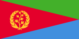
Eritrea
State of Eritrea
Population: UN WPP 2024, revision 1, projection for 1 July 2026. Sources and methodology.
Geography and territory
Eritrea occupies a strategic stretch of the Horn of Africa, fronting the Red Sea along a coastline that runs for more than 1,000 kilometers and encompasses the Dahlak Archipelago, a scattering of over 200 mostly uninhabited islands and coral islets. Covering 117,600 square kilometers, the country packs an unusual amount of geographic variety into a modest footprint, moving from arid coastal plains to a cool central highland plateau and on to desert depressions in the south.
The central highlands, sitting between roughly 1,800 and 2,500 meters above sea level, form the demographic and agricultural heart of the nation. Asmara, the capital, sits atop this plateau and enjoys a mild, spring-like climate year-round thanks to its elevation. Mount Soira, at 3,018 meters, is the country’s highest point and belongs to the dramatic escarpment that plunges from the highlands down toward the Red Sea coastal plain, carving out canyons and cliffs along the way.
The eastern coastal belt ranks among the hottest regions on Earth, with the Danakil Depression, shared with Ethiopia and Djibouti, regularly recording temperatures above 50 degrees Celsius. This geologically restless zone lies below sea level and is one of the most forbidding landscapes on the planet, dotted with active volcanoes, hot springs, salt lakes, and mineral formations in surreal colors. Offshore, Eritrea’s section of the Red Sea shelters pristine coral reefs and abundant marine life that remain almost entirely unexplored by dive tourism.
History
Eritrea’s territory carries a history stretching back to the roots of human civilization, with archaeological finds suggesting hominid presence in the region well over a million years ago. In antiquity, the area formed part of the Kingdom of Aksum, one of the great civilizations of the ancient world, which flourished between the 1st and 7th centuries AD and was among the earliest states anywhere to adopt Christianity as an official religion. Eritrean Red Sea ports served as vital links in trade networks connecting the Mediterranean, Arabia, India, and East Africa.
Over the following centuries, competing powers, including Ottoman and Egyptian forces, vied for control of the region before it fell under Italian colonial rule in the late 19th century. Italy formally established the colony of Eritrea in 1890, taking its name from the Greek term for the Red Sea, and reshaped the territory with railways, infrastructure, and the urban planning that turned Asmara into a showcase of Italian modernist architecture. After Italy’s defeat in World War II, the United Nations placed Eritrea in federation with Ethiopia in 1952.
Ethiopia’s unilateral annexation of the territory in 1962 triggered one of Africa’s longest wars of independence, a thirty-year struggle from 1961 to 1991. The Eritrean People’s Liberation Front waged a determined guerrilla campaign against a far better-resourced adversary, even building underground hospitals and workshops into the mountainsides. Independence, confirmed by a 1993 referendum in which 99.8 percent voted in favor, came at enormous human cost. Tensions with Ethiopia flared again in a border war between 1998 and 2000, and the wounds of that conflict only began to heal with a 2018 peace agreement.
Culture and society
Eritrea is home to nine officially recognized ethnic groups, each with its own language, customs, and way of life, producing a remarkably diverse cultural landscape for a country of its size. The Tigrinya, who make up the majority of the population, share linguistic and cultural ties with northern Ethiopia. The Tigre, Afar, Saho, Bilen, Kunama, Nara, Rashaida, and Hedareb round out a mosaic that spans highland farming communities, coastal nomadic herders, and lowland pastoralists.
One of the most distinctive features of Eritrean society is the harmonious coexistence of Christianity and Islam, which divide the population roughly evenly. This interfaith balance, uncommon in a region often marked by sectarian tension, shows up in shared festivals, intermarriage, and a tradition of mutual tolerance that Eritreans regard as a point of national pride. Celebrations such as Meskel, the Orthodox Christian feast of the Cross, and Eid al-Fitr, marking the end of Ramadan, are embraced across the whole community.
Music in Eritrea mirrors the country’s linguistic diversity, with each ethnic group contributing its own styles, instruments, and dances. Traditional instruments include the krar, a five-stringed lyre, the wata, a one-stringed fiddle, and the kebero drum, all of which accompany both religious ceremonies and popular festivities. The guayla, a circle dance performed by men and women together to driving percussion, is the most visible expression of communal joy at Eritrean celebrations, while a still-young national literature explores themes of struggle, exile, and nation-building in multiple languages.
Economy
Eritrea has one of the smallest economies in Africa, shaped by decades of conflict and a long period of international isolation. Subsistence agriculture employs the bulk of the workforce, centered on cereal crops such as teff, sorghum, millet, and barley in the highlands, alongside livestock herding in pastoral zones. Erratic rainfall and soil degradation make food security a persistent challenge, with recurring droughts threatening harvests.
Mining has emerged as an increasingly important source of revenue in recent years, with gold, copper, zinc, and potash deposits under development. The Bisha mine, operating since 2011, has been the country’s flagship mining project, drawing foreign investment into an economy that has otherwise pursued a policy of self-reliance and limited external dependence. Fishing in the resource-rich waters of the Red Sea and salt production offer additional, still largely untapped economic potential.
Remittances from the large Eritrean diaspora, scattered worldwide as a result of past conflicts and difficult domestic conditions, form a crucial pillar of the national economy. The government has emphasized self-sufficiency and prioritized agriculture, education, and basic infrastructure in its development strategy. Key challenges going forward include diversifying production, attracting foreign investment, building out tourism infrastructure, and deepening regional trade ties that were constrained for years by tensions with neighboring states.
Food and cuisine
Eritrean cuisine centers on injera, a spongy fermented flatbread made from teff, the ancient grain native to the Horn of Africa. Injera does triple duty as plate, tablecloth, and utensil: it is spread across a large communal tray, topped with an assortment of stews and sauces, and diners tear off pieces with their right hand to scoop up each dish. This shared, hands-on style of eating around a single tray lies at the heart of the Eritrean dining experience.
Tsebhi, richly spiced stews of meat or legumes, are the essential partner to injera. Tsebhi birsen, a red lentil stew seasoned with berbere; zigini, a spiced beef stew; dorho tsebhi, a chicken stew; and shiro, a chickpea puree, are everyday dishes bursting with complex flavor. Berbere, a spice blend built from chile, cumin, coriander, ginger, clove, and cardamom among other ingredients, is the soul of Eritrean cooking, and families often guard their own version of the recipe closely.
The Eritrean coffee ceremony ranks among Africa’s most elaborate and cherished social rituals. Green coffee beans are roasted in front of guests over a small brazier, ground by hand with a mortar and pestle, and brewed in a long-necked clay pot called a jebena, then served in three successive rounds of decreasing strength known as awel, kalaay, and bereka. The ceremony, which can stretch past an hour, is accompanied by burning incense, popcorn, and sweets, and stands as a profound expression of hospitality. Suwa, a home-brewed barley and hops beer, and mes, a traditional honey mead, are the country’s signature alcoholic drinks.
Tourism and landmarks
Asmara is an architectural gem unlike anywhere else in Africa. Inscribed as a UNESCO World Heritage Site in 2017 as an outstanding example of early 20th-century modernist urban planning, the city preserves a remarkable collection of Art Deco, Futurist, Rationalist, and Neoclassical buildings erected under Italian colonial rule. Highlights include the futuristic Cinema Impero, the Fiat Tagliero service station with its aircraft-like cantilevered wings, a Romanesque-style Catholic cathedral, and a grand mosque built in Ottoman style, together forming an architectural walking tour with no real parallel.
The Dahlak Islands, scattered across the Red Sea, remain an almost untouched archipelago offering some of the finest diving conditions in the world. Pristine coral reefs, crystalline waters teeming with tropical fish, sea turtles, manta rays, and sharks, and deserted beaches make this a destination that the few travelers who reach it describe as an intact paradise. Ruins of an ancient Aksumite settlement on Dahlak Kebir and the wrecks of Italian and Ottoman vessels add a layer of history to the diving.
Massawa, Eritrea’s principal port city, was once known as the Pearl of the Red Sea. Its old town, built across two islands linked by causeways, blends Ottoman, Egyptian, and Italian architecture, though much of it still bears the evocative scars of the independence war. The Eritrean Railway, a feat of early 20th-century Italian engineering that climbs from Massawa up to Asmara through dramatic curves, tunnels, and bridges, has been partially restored and offers one of Africa’s most scenic train journeys, still occasionally run with original steam locomotives.
Fun facts about Eritrea
- Asmara was named a UNESCO World Heritage Site in 2017 for its extraordinary collection of early 20th-century modernist architecture, a designation unique in Africa.
- The Fiat Tagliero service station in Asmara, built in 1938 with two 15-meter concrete wings that appear to float without support columns, is celebrated as a masterpiece of Futurist design.
- Eritrea’s independence followed Africa’s longest war of liberation, a thirty-year struggle from 1961 to 1991 during which fighters built hospitals, schools, and even a sandal factory inside mountain tunnels.
- The Eritrean Railway climbs more than 2,000 meters from the Red Sea to Asmara in just 118 kilometers, passing through 30 tunnels and over 65 bridges.
- Eritrea is one of the world’s youngest independent nations, having gained sovereignty in 1993, and one of the few countries where Christians and Muslims coexist in roughly equal numbers with notable harmony.
Eritrea in numbers
Latest World Bank and UNDP observations, each with its own year. “World median” is the middle value among the countries that report the same indicator; “#” ranks from the highest value.
Population since 1960
Eritrea had 972,547 people in 1960 and 3.6 million in 2025 — 3.7 times as many.
People
34.5% of people live in towns and cities (world median 63.4%). 37.6% are under 15 and 4.3% are 65 or older — a young population. Women have 3.68 children on average, above the replacement level of about 2.1.
Economy
Development and environment
UNDP rates human development in Eritrea as low, with an index of 0.503 in 2023 (rank 178 of 193). 14.3% of people use the internet and 55.3% have access to electricity. Forest covers 12.0% of the land (world median 32.8%).
Sources: World Bank, World Development Indicators (CC BY 4.0), most recent observation from 2015 onward; UNDP Human Development Report 2025. Retrieved 2026-10-10. Sector shares need not add up to 100% because taxes and subsidies on products are excluded. Missing values are left blank rather than estimated. Sources and methodology.
Climate of Eritrea
Averaged across Eritrea, the warmest month is June (29.8 °C) and the coolest is January (22.6 °C), a seasonal swing of 7.2 °C. The annual mean is 26.6 °C.
About 271 mm of precipitation falls in a typical year. August is the wettest month (77 mm) and March the driest (7 mm). The three wettest consecutive months, July to September, bring 64% of the year's total — a pronounced rainy season.
Show monthly values as a table
| Month | Mean °C | Low °C | High °C | Precipitation, mm |
|---|---|---|---|---|
| January | 22.6 | 15.9 | 29.3 | 9 |
| February | 23.8 | 17.0 | 30.8 | 7 |
| March | 25.3 | 18.3 | 32.3 | 7 |
| April | 27.5 | 20.7 | 34.4 | 11 |
| May | 28.8 | 22.4 | 35.3 | 16 |
| June | 29.8 | 23.0 | 36.6 | 17 |
| July | 29.3 | 23.5 | 35.2 | 70 |
| August | 28.7 | 23.1 | 34.4 | 77 |
| September | 28.1 | 21.9 | 34.3 | 27 |
| October | 27.0 | 20.8 | 33.2 | 9 |
| November | 25.3 | 18.8 | 31.9 | 11 |
| December | 23.3 | 16.9 | 29.8 | 12 |
Figures are 1991–2020 averages across the whole land area of Eritrea, from the World Bank Climate Change Knowledge Portal, CRU TS 4.08 (CC BY 4.0). They are not readings from one weather station: the capital, the coast and high ground can be much warmer, cooler, wetter or drier.
Travel essentials for Eritrea
The practical details visitors ask about first. Traffic in Eritrea drives on the right, like most of the world. Mains electricity is 230 V at 50 Hz, so devices made only for 110–120 V (common in North America) need a converter unless they are dual-voltage — most phone and laptop chargers are.
- Emergency number
- 113
- Driving side
- Right
- Plug types
- Type C, Type LC: two round pins (Europlug); L: three round pins in a row (Italian)
- Voltage
- 230 V50 Hz
- Dialling code
- +291From abroad: your exit code, then 291 and the number
- Currency
- Nakfa (ERN)
- Time zone
- EAT (UTC+3)Current local time in Eritrea
Compiled from IEC plug and voltage standards, national emergency-service listings and the UN road-traffic conventions. Emergency numbers and local coverage can change — confirm them locally on arrival. Eritrea's internet domain is .er.
Where Eritrea ranks in the world
Each position counts only the countries with data in that ranking guide. First place is the highest value — for price levels, the most expensive. Select a card to see the full table.
Bordering countries of Eritrea


Compare Eritrea with another country
Frequently asked questions about Eritrea
What is the capital of Eritrea?
The capital of Eritrea is Asmara.
What is the population of Eritrea?
The UN World Population Prospects projection for Eritrea is 3,682,669 people (3.7 million) on 1 July 2026. National statistical offices may publish different estimates.
What language is spoken in Eritrea?
The official language of Eritrea is Tigrinya, Arabic and English.
What currency is used in Eritrea?
The currency of Eritrea is the Nakfa (ERN).
How big is Eritrea?
Eritrea covers an area of 117,600 km².
What type of government does Eritrea have?
Eritrea is a one-party presidential republic.
Which countries border Eritrea?
Eritrea shares land borders with Sudan, Ethiopia, Djibouti.
What is the highest point in Eritrea?
The highest point in Eritrea is Mount Soira (3,018 m).


