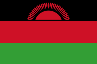
Malawi
Republic of Malawi
Population: UN WPP 2024, revision 1, projection for 1 July 2026. Sources and methodology.
Geography and territory
Malawi is a long, narrow, landlocked country in southeastern Africa, covering 118,484 square kilometers, of which roughly a fifth is water. It borders Tanzania to the north and northeast, Mozambique along its eastern, southern, and southwestern edges, and Zambia to the west. Its geography is dominated by the Great African Rift Valley, which runs the length of the country from north to south and cradles Lake Malawi, the single most defining feature of the nation.
Lake Malawi, also known as Lake Nyasa, is the third-largest lake in Africa and the ninth-largest in the world, stretching some 580 kilometers with a maximum width of 75 kilometers. Its clear waters plunge to depths exceeding 700 meters and shelter the greatest concentration of freshwater fish species found anywhere on the planet, with more than a thousand species of cichlid, the vast majority endemic — a natural laboratory of evolution often compared to the Galápagos Islands.
Malawi’s terrain ranges from the low-lying, warm Shire Valley in the south to elevated plateaus in the center and mountains in the north and southeast. Mount Mulanje, at 3,002 meters, is the country’s highest point and one of the highest points in southern Africa east of the Rift Valley, a massive granite outcrop that rises abruptly from the surrounding plains and shelters endemic cedar forests and unique plant life. The climate is subtropical, with a wet season running from November to April and a cooler dry season from May to August.
With a population of about 22.8 million spread across this relatively compact territory, Malawi is one of the more densely settled countries in the region, and pressure on arable land near the lake and in the southern highlands has become an increasingly pressing concern for planners and farming communities alike.
History
The territory of present-day Malawi has been inhabited since ancient times, with archaeological evidence pointing to human presence more than 50,000 years ago. Bantu-speaking peoples arrived in successive waves beginning around the first century AD, bringing agriculture, ironworking, and organized social structures. The Maravi Empire, which flourished between the fifteenth and eighteenth centuries and gave the country its name, spread across a vast territory covering parts of present-day Mozambique and Zambia and controlled lucrative ivory and iron trade routes.
Portuguese traders were the first Europeans to make contact with the region, establishing commercial ties from the sixteenth century onward. It was the Scottish explorer David Livingstone, however, who put Malawi on the European map after reaching the lake in 1859 and publicizing the horrors of the Arab-run slave trade devastating the region. Christian missions and mounting British pressure against the slave trade led to the establishment of the Nyasaland Protectorate in 1891.
The independence movement, led by Dr. Hastings Kamuzu Banda, achieved independence on July 6, 1964. Banda declared himself “president for life” in 1971 and ran an authoritarian one-party state for three decades. Democratic transition arrived in 1994 with the country’s first multiparty elections, in which Bakili Muluzi defeated Banda. Malawi’s democracy has since matured, most notably in 2020, when the country’s judiciary annulled a presidential election over irregularities — an unprecedented step in African political history that demonstrated the independence of Malawi’s courts.
Culture and society
Malawi is often called “the warm heart of Africa,” a nickname that accurately captures the hospitality and warmth visitors routinely encounter. Malawian society encompasses a range of ethnic groups, with the Chewa the most numerous, followed by the Lomwe, Yao, Tumbuka, and Ngoni. Chichewa, the language of the Chewa people, serves as the national language alongside English and acts as the principal means of communication across the country’s diverse communities.
Music and dance sit at the heart of Malawian cultural life, accompanying everything from religious ceremonies to agricultural labor. Gule wamkulu, a ritual masked dance performed by the secretive Nyau society of the Chewa people, has been inscribed by UNESCO as an Intangible Cultural Heritage of Humanity. Dancers, covered in elaborate costumes of raffia, cloth, and wood representing ancestral spirits and wild animals, perform dramatic routines at funerals, initiation ceremonies, and community festivals.
Malawian craftsmanship is distinguished above all by the exceptional quality of its basketry, woven from natural fibers dyed with plant pigments into striking geometric patterns. Malawian baskets and mats enjoy international recognition, valued both as everyday objects and as collectible art. Woodcarving, traditional pottery, and chitenge textiles — the brightly patterned cloths used as clothing and for carrying babies — round out a rich and varied artisan tradition.
Economy
Malawi’s economy remains among the least developed in the world, heavily reliant on agriculture, which employs more than 80 percent of the working population. Tobacco is by far the most important cash crop, accounting for roughly half of export earnings, which leaves the country dangerously dependent on a single commodity subject to volatile international prices and global anti-smoking campaigns. Tea and sugar are the other leading export crops.
Maize is the essential subsistence crop, though production is frequently disrupted by drought, flooding, and soil degradation, leading to recurring episodes of food insecurity. The government and international organizations have pushed to diversify agriculture toward crops such as soybeans, legumes, and groundnuts, along with more climate-resilient farming techniques.
Lake Malawi supports a significant artisanal fishing industry that supplies essential protein to the national diet, although overfishing of some species has reduced catches in recent decades. Tourism, centered on the lake and the country’s national parks, holds considerable growth potential but remains underdeveloped. Mining of uranium, rare earth elements, and bauxite offers a path toward economic diversification, though extractive projects have sparked debate over their environmental and social impact. With a GDP of $14.92 billion and a Human Development Index of 0.517, classified as low, Malawi still faces steep development challenges.
Food and cuisine
Malawian food is simple, nourishing, and deeply rooted in what the land and the lake provide. Nsima, a firm porridge made from maize flour cooked in water, is the foundation of the Malawian diet and the local equivalent of ugali found elsewhere in East Africa. It is cooked to a dense consistency that allows diners to shape small portions by hand and dip them into the accompaniments that provide flavor and variety.
Chambo, a type of tilapia endemic to Lake Malawi, is the country’s most prized fish and appears grilled, fried, stewed, or sun-dried. Ndiwo, a general term for the stews and relishes served alongside nsima, might be made from leafy greens such as mustard or pumpkin leaves, beans, groundnuts, tomatoes, or meat. Kondowole, a cassava-flour dish prepared much like nsima, is popular in southern regions where cassava is more abundant than maize.
Meals are typically communal, with families seated on the floor around a shared dish and washing their hands in a basin of water before eating. Thobwa, a thick, sweet drink made from fermented maize flour, is extremely popular and consumed both as food and as a refreshment. Chibuku, a home-brewed maize beer, is the most widespread social drink, sold in carton packaging across the country and shared generously at gatherings and celebrations.
Tourism and landmarks
Lake Malawi is the country’s premier attraction, combining golden sand beaches, crystalline water, and unrivaled aquatic biodiversity. Lake Malawi National Park, a UNESCO World Heritage Site, protects the waters and shoreline at the lake’s southern end around the Cape Maclear peninsula, where visitors can snorkel and dive among hundreds of brilliantly colored cichlid species darting through submerged rock formations.
Likoma Island, situated in Mozambican waters of the lake but belonging to Malawi, surprises visitors with the Anglican Cathedral of St. Peter, an imposing stone church roughly the size of Winchester Cathedral, built by missionaries in the early twentieth century. The island’s beaches, along with those of nearby Chizumulu Island, offer a tranquil, secluded escape. Nyika National Park, in the far north, protects the largest plateau in Central Africa, its rolling grasslands carpeted with wildflowers and home to zebra, antelope, and the occasional leopard sighting.
Liwonde National Park, along the Shire River, offers boat safaris for viewing elephants, hippos, crocodiles, and an extraordinary variety of birdlife in an intimate, uncrowded setting. Mount Mulanje, with its sheer granite faces and high plateaus covered in endemic cedar forest, draws hikers and climbers alike. Lilongwe, the capital, and Blantyre, the country’s largest city, offer vibrant markets, museums, and a growing cultural scene. The tea estates of Thyolo, with hillsides of deep green, create a landscape of quiet beauty reminiscent of the highlands of Sri Lanka.
Fun facts about Malawi
- Lake Malawi holds more species of freshwater fish than any other lake in the world, with over a thousand cichlid species, most of them endemic.
- Malawi is nicknamed “the warm heart of Africa” for the exceptional hospitality of its people.
- In 2020, Malawi’s Constitutional Court annulled a presidential election over irregularities, an unprecedented event in African history that drew international praise.
- Gule wamkulu, the Chewa people’s ritual masked dance, is recognized by UNESCO as an Intangible Cultural Heritage of Humanity.
- Mount Mulanje shelters the Mulanje cedar, an endemic tree species now critically endangered.
- David Livingstone, the Scottish explorer, reached Lake Malawi in 1859 and described it as “the lake of stars” for the way fishermen’s lanterns shimmered across its waters at night.
Malawi in numbers
Latest World Bank and UNDP observations, each with its own year. “World median” is the middle value among the countries that report the same indicator; “#” ranks from the highest value.
Population since 1960
Malawi had 3.6 million people in 1960 and 22.2 million in 2025 — 6.1 times as many.
People
17.6% of people live in towns and cities (world median 63.4%). 40.1% are under 15 and 2.6% are 65 or older — a very young population. Women have 3.59 children on average, above the replacement level of about 2.1.
Economy
The economy grew by 1.9% in real terms in 2025. Consumer prices rose by 28.4% in 2025 — very high inflation. Services make up the largest share of output (48.7% of GDP); agriculture contributes 30.0%, a large share that points to a farming-based economy.
Development and environment
UNDP rates human development in Malawi as low, with an index of 0.517 in 2023 (rank 172 of 193). 19.0% of people use the internet and 15.6% have access to electricity. Forest covers 22.0% of the land (world median 32.8%).
Sources: World Bank, World Development Indicators (CC BY 4.0), most recent observation from 2015 onward; UNDP Human Development Report 2025. Retrieved 2026-10-10. Sector shares need not add up to 100% because taxes and subsidies on products are excluded. Missing values are left blank rather than estimated. Sources and methodology.
Climate of Malawi
Averaged across Malawi, the warmest month is November (25.7 °C) and the coolest is July (18.7 °C), a seasonal swing of 7.0 °C. The annual mean is 22.7 °C.
About 1,046 mm of precipitation falls in a typical year. January is the wettest month (243 mm) and September the driest (3 mm). The three wettest consecutive months, December to February, bring 61% of the year's total — a pronounced rainy season.
Show monthly values as a table
| Month | Mean °C | Low °C | High °C | Precipitation, mm |
|---|---|---|---|---|
| January | 24.0 | 19.7 | 28.4 | 243 |
| February | 23.9 | 19.6 | 28.3 | 204 |
| March | 23.8 | 19.2 | 28.4 | 190 |
| April | 22.7 | 17.8 | 27.6 | 92 |
| May | 21.1 | 15.5 | 26.7 | 25 |
| June | 19.3 | 13.2 | 25.4 | 9 |
| July | 18.7 | 12.6 | 24.9 | 6 |
| August | 20.3 | 14.0 | 26.6 | 4 |
| September | 22.8 | 16.2 | 29.4 | 3 |
| October | 25.0 | 18.8 | 31.3 | 15 |
| November | 25.7 | 20.1 | 31.4 | 61 |
| December | 24.7 | 20.1 | 29.4 | 195 |
Figures are 1991–2020 averages across the whole land area of Malawi, from the World Bank Climate Change Knowledge Portal, CRU TS 4.08 (CC BY 4.0). They are not readings from one weather station: the capital, the coast and high ground can be much warmer, cooler, wetter or drier.
Travel essentials for Malawi
The practical details visitors ask about first. Traffic in Malawi drives on the left, one of 54 of the 196 countries profiled here that do — see the full list. Mains electricity is 230 V at 50 Hz, so devices made only for 110–120 V (common in North America) need a converter unless they are dual-voltage — most phone and laptop chargers are.
- Emergency number
- 997Ambulance 998 · Fire 999
- Driving side
- Left
- Plug types
- Type GG: three rectangular pins (British)
- Voltage
- 230 V50 Hz
- Dialling code
- +265From abroad: your exit code, then 265 and the number
- Currency
- Malawian Kwacha (MWK)
- Time zone
- CAT (UTC+2)Current local time in Malawi
Compiled from IEC plug and voltage standards, national emergency-service listings and the UN road-traffic conventions. Emergency numbers and local coverage can change — confirm them locally on arrival. Malawi's internet domain is .mw.
Where Malawi ranks in the world
Each position counts only the countries with data in that ranking guide. First place is the highest value — for price levels, the most expensive. Select a card to see the full table.
- Population62nd of 19622.8 millionUN projection, July 2026
- Land area107th of 19594,280 km²World Bank, 2023
- Population density47th of 194224 per km²World Bank, 2023
- GDP (nominal)145th of 187$11.3BWorld Bank, 2024, current US$
- GDP per capita184th of 187$522World Bank, 2024, current US$
- Life expectancy148th of 19467.6 yearsWorld Bank, 2024
- Price level126th of 16535 (US = 100)ICP 2021, household consumption
Bordering countries of Malawi


Compare Malawi with another country
Frequently asked questions about Malawi
What is the capital of Malawi?
The capital of Malawi is Lilongwe.
What is the population of Malawi?
The UN World Population Prospects projection for Malawi is 22,785,535 people (22.8 million) on 1 July 2026. National statistical offices may publish different estimates.
What language is spoken in Malawi?
The official language of Malawi is Chichewa and English.
What currency is used in Malawi?
The currency of Malawi is the Malawian Kwacha (MWK).
How big is Malawi?
Malawi covers an area of 118,484 km².
What type of government does Malawi have?
Malawi is a presidential republic.
Which countries border Malawi?
Malawi shares land borders with Tanzania, Mozambique, Zambia.
What is the highest point in Malawi?
The highest point in Malawi is Mount Mulanje (3,002 m).


