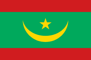
Mauritania
Islamic Republic of Mauritania
Population: UN WPP 2024, revision 1, projection for 1 July 2026. Sources and methodology.
Geography and territory
Mauritania occupies 1,030,700 square kilometers in northwest Africa, making it one of the largest countries on the continent yet also one of the most sparsely populated, with only a handful of people per square kilometer across most of its land. The Sahara Desert swallows roughly three-quarters of the national territory, stretching from the Atlantic coast in the west to the borders with Algeria, Mali, Senegal, Western Sahara, and Morocco. This vast emptiness of dunes, gravel plains, and dry rocky plateaus defines the country’s character far more than any city or river.
The terrain is a study in contrasts. In the far south, along the Senegal River, a narrow Sahelian band of grasses and scattered trees offers a green counterpoint to the desert that dominates everywhere else. Dry riverbeds called wadis fill briefly during the sparse rainy season before vanishing again into sand. The country’s highest point, Kediet ej Jill, rises 915 meters near the mining town of Zouérat and is composed almost entirely of iron ore, a geological quirk that has shaped the national economy for decades.
Along the Atlantic seaboard, Mauritania’s roughly 750 kilometers of coastline harbor some of the richest fishing grounds on Earth. The Banc d’Arguin National Park, a UNESCO World Heritage Site where desert meets ocean in a maze of sandbanks, shallow lagoons, and mangroves, ranks among the planet’s most important wintering grounds for migratory birds arriving from Europe and Siberia. The climate is harshly arid, with interior summer temperatures frequently soaring past 50 degrees Celsius, while coastal areas are tempered somewhat by Atlantic breezes.
History
Long before it became one of the driest nations on Earth, the region that is now Mauritania was a far greener, wetter place. Rock paintings scattered across the country depict hunter-gatherers and herders who lived here more than 5,000 years ago, when the Sahara was still savanna. As the climate shifted and the desert advanced, these populations retreated toward oases and the south, giving rise to the nomadic traditions that have shaped Mauritanian society ever since.
From the eighth century onward, the spread of Islam turned the region into a vital crossroads of trans-Saharan trade, linking sub-Saharan Africa with the Maghreb and, ultimately, Europe. The empire of Ghana, centered at Koumbi Saleh within present-day Mauritania, grew wealthy controlling the exchange of gold and salt. Later, the Almoravids, a confederation of Sanhaja Berber tribes that originated in this territory, built an empire in the eleventh century stretching from the Senegal River all the way to the Iberian Peninsula.
French colonization took hold gradually from the mid-nineteenth century, formalized as an overseas territory in 1904. Independence arrived on November 28, 1960, under President Moktar Ould Daddah, who faced the daunting task of forging a modern nation-state out of a territory inhabited largely by nomadic communities. The decades since have brought military coups, the costly Western Sahara conflict of the 1970s, and a gradual, still-unfinished movement toward democratic governance, with real progress achieved in recent years.
Culture and society
Mauritania sits at a cultural crossroads between Arab-Berber North Africa and Black sub-Saharan Africa, and its society reflects that dual heritage. Arabic-speaking Moors, both Bidhan and Haratine, live alongside Black African communities such as the Halpulaar, Soninke, and Wolof, each maintaining distinct languages, customs, and social structures within a shared national identity.
Oral tradition and poetry hold a place of deep honor, particularly among Moorish communities, where griots and religious scholars have preserved a rich literary heritage in classical Arabic and Hassaniya for centuries. Traditional music, played on instruments like the tidinit, a four-stringed lute, and the ardin, a harp reserved for women performers, accompanies weddings, celebrations, and everyday gatherings. Female griots, known as iggawin, are the principal keepers of this musical inheritance.
Clothing signals identity and status: Moorish men wear the flowing boubou robe with a wrapped turban, while women drape themselves in the malafa, a brightly colored veil worn with striking elegance. Though the nomadic way of life has receded in the face of urbanization, it remains a touchstone of national identity, and the traditional tent, or khaima, still symbolizes Mauritanian hospitality. Tea, brewed ceremonially in three successive rounds of increasing sweetness, anchors social life and is offered to every guest as an essential gesture of welcome.
Economy
Mauritania’s economy rests on three pillars: mining, fishing, and livestock herding. Iron ore extracted around Zouérat and hauled more than 700 kilometers across the desert by one of the world’s longest freight trains to the port of Nouadhibou remains the country’s chief source of export revenue. The train, whose loaded formations can stretch beyond two kilometers, has become something of a national icon in its own right.
Fishing in Mauritania’s exceptionally productive Atlantic waters forms another vital pillar of the economy. Nouadhibou, the country’s economic capital, hosts a dense cluster of processing plants that ship fish and shellfish to markets in Europe and Asia. Overfishing by foreign fleets, however, poses an ongoing threat to the long-term health of these fisheries. Livestock herding, practiced by nomadic and semi-nomadic communities who move camels, cattle, goats, and sheep with the seasonal pastures, continues to sustain large portions of the rural population.
More recently, offshore discoveries of oil and natural gas have opened new economic possibilities for a country whose GDP stands at roughly $11.7 billion. Agriculture, constrained by scarce water, is concentrated along the fertile Senegal River valley, where farmers grow rice, millet, and sorghum. Despite these resources, Mauritania continues to grapple with widespread poverty, inequality, and advancing desertification, reflected in a human development index of 0.563, placed in the medium category.
Food and cuisine
Mauritanian food mirrors the country’s cultural duality, blending Arab-Berber and sub-Saharan culinary traditions. Mechoui, a whole lamb slow-roasted over coals, is the most ceremonial dish, reserved for weddings and religious holidays. Camel meat, prepared fresh or dried, remains a staple among desert-dwelling nomadic communities and is prized for its versatility.
Thieboudienne, adopted from neighboring Senegal, is among the most popular dishes in southern Mauritania, made of rice, fish, and vegetables simmered in a spiced tomato sauce. Couscous made from millet or wheat, served alongside meat and vegetables, is another staple across the country. Camel milk, drunk fresh or fermented into zrig, holds central nutritional and cultural importance for nomadic families, valued as both food and folk remedy.
Mauritanian tea, brewed from Chinese green tea, generous amounts of sugar, and fresh mint, is far more than a beverage: it is a social ritual that structures daily life. Traditionally prepared by men through a precise sequence of three infusions, each with a different strength, tea-making is treated as an art form. Dates, wheat biscuits, and dried fruit round out the desert diet, while fresh and smoked fish dominate the tables of coastal communities.
Tourism and landmarks
The Banc d’Arguin National Park, a UNESCO World Heritage Site on the Atlantic coast, is Mauritania’s greatest natural treasure and one of the world’s foremost sanctuaries for migratory birds. The park protects an immense expanse of sandbanks, islands, mangroves, and shallow waters where millions of birds from Europe and Siberia spend the winter. The Imraguen fishermen who inhabit the park practice an ancestral technique of fishing in cooperation with wild dolphins.
The ancient caravan towns of the interior offer an entirely different kind of wonder. Chinguetti, Ouadane, Tichitt, and Oualata, the four ksour recognized collectively as a UNESCO World Heritage Site, once served as major hubs of trans-Saharan trade and Islamic scholarship. Chinguetti, regarded as the seventh holiest city in Islam, still holds family libraries with manuscripts dating to the ninth century, its austere mosques rising from the dunes like mirages of a distant past.
The desert itself delivers landscapes of overwhelming scale, from the towering dunes of the Erg Ouarane to the rugged Adrar massif and the enigmatic Richat Structure, a circular geological formation 50 kilometers wide, visible from space and popularly nicknamed the Eye of the Sahara. Camel treks and four-wheel-drive expeditions across these vast, silent spaces, beneath some of the clearest night skies on Earth, offer travelers a genuinely transformative experience.
Fun facts about Mauritania
- The iron-ore train running from Zouérat to Nouadhibou is among the longest trains in the world, with formations reaching up to 2.5 kilometers, and travelers can ride in the open cargo cars for free
- The Richat Structure, often called the Eye of the Sahara, is a 50-kilometer-wide circular formation visible from orbit whose geological origin is still debated by scientists
- Mauritania was among the last countries in the world to abolish slavery in law, with its most recent anti-slavery legislation enacted in 2007
- Nouakchott, the capital, was little more than a small fishing settlement when it was chosen as the seat of government in 1957, just three years before independence
- Imraguen fishermen at the Banc d’Arguin use a unique method of slapping the water to summon wild dolphins, which help drive schools of fish toward their nets
- Burping after a meal is considered polite in Mauritania, a sign that the food offered by the host was thoroughly satisfying
Mauritania in numbers
Latest World Bank and UNDP observations, each with its own year. “World median” is the middle value among the countries that report the same indicator; “#” ranks from the highest value.
Population since 1960
Mauritania had 824,298 people in 1960 and 5.3 million in 2025 — 6.4 times as many.
People
61.5% of people live in towns and cities (world median 63.4%). 42.4% are under 15 and 3.2% are 65 or older — a very young population. Women have 4.63 children on average, above the replacement level of about 2.1.
Economy
The economy grew by 4.0% in real terms in 2025. Consumer prices rose by 1.5% in 2025. Services make up the largest share of output (42.4% of GDP); agriculture contributes 20.0%.
Development and environment
UNDP rates human development in Mauritania as medium, with an index of 0.563 in 2023 (rank 163 of 193). 45.8% of people use the internet and 52.2% have access to electricity. Forest covers 1.0% of the land (world median 32.8%).
Sources: World Bank, World Development Indicators (CC BY 4.0), most recent observation from 2015 onward; UNDP Human Development Report 2025. Retrieved 2026-10-10. Sector shares need not add up to 100% because taxes and subsidies on products are excluded. Missing values are left blank rather than estimated. Sources and methodology.
Climate of Mauritania
Averaged across Mauritania, the warmest month is July (34.3 °C) and the coolest is January (20.8 °C), a seasonal swing of 13.5 °C. The annual mean is 28.8 °C.
About 110 mm of precipitation falls in a typical year. August is the wettest month (42 mm) and March the driest (0 mm). What little rain there is falls mostly from July to September (81% of the total).
Less than 250 mm a year is typical of desert climates.
Show monthly values as a table
| Month | Mean °C | Low °C | High °C | Precipitation, mm |
|---|---|---|---|---|
| January | 20.8 | 14.5 | 27.1 | 1 |
| February | 23.3 | 16.5 | 30.1 | 1 |
| March | 26.6 | 19.7 | 33.7 | 0 |
| April | 29.6 | 22.3 | 36.9 | 1 |
| May | 32.4 | 25.2 | 39.6 | 1 |
| June | 34.1 | 27.1 | 41.0 | 6 |
| July | 34.3 | 27.8 | 40.9 | 19 |
| August | 33.2 | 27.0 | 39.5 | 42 |
| September | 32.7 | 26.5 | 39.0 | 28 |
| October | 30.7 | 24.2 | 37.2 | 8 |
| November | 26.1 | 19.7 | 32.6 | 1 |
| December | 21.7 | 15.3 | 28.1 | 1 |
Figures are 1991–2020 averages across the whole land area of Mauritania, from the World Bank Climate Change Knowledge Portal, CRU TS 4.08 (CC BY 4.0). They are not readings from one weather station: the capital, the coast and high ground can be much warmer, cooler, wetter or drier.
Travel essentials for Mauritania
The practical details visitors ask about first. Traffic in Mauritania drives on the right, like most of the world. Mains electricity is 220 V at 50 Hz, so devices made only for 110–120 V (common in North America) need a converter unless they are dual-voltage — most phone and laptop chargers are.
- Emergency number
- 117
- Driving side
- Right
- Plug types
- Type CC: two round pins (Europlug)
- Voltage
- 220 V50 Hz
- Dialling code
- +222From abroad: your exit code, then 222 and the number
- Currency
- Ouguiya (MRU)
- Time zone
- GMT (UTC+0)Current local time in Mauritania
Compiled from IEC plug and voltage standards, national emergency-service listings and the UN road-traffic conventions. Emergency numbers and local coverage can change — confirm them locally on arrival. Mauritania's internet domain is .mr.
Where Mauritania ranks in the world
Each position counts only the countries with data in that ranking guide. First place is the highest value — for price levels, the most expensive. Select a card to see the full table.
- Population122nd of 1965.5 millionUN projection, July 2026
- Land area28th of 1951,030,700 km²World Bank, 2023
- Population density185th of 1944.9 per km²World Bank, 2023
- GDP (nominal)147th of 187$10.9BWorld Bank, 2024, current US$
- GDP per capita150th of 187$2,105World Bank, 2024, current US$
- Life expectancy141st of 19468.7 yearsWorld Bank, 2024
- Price level134th of 16534 (US = 100)ICP 2021, household consumption
Bordering countries of Mauritania


Compare Mauritania with another country
Frequently asked questions about Mauritania
What is the capital of Mauritania?
The capital of Mauritania is Nouakchott.
What is the population of Mauritania?
The UN World Population Prospects projection for Mauritania is 5,461,319 people (5.5 million) on 1 July 2026. National statistical offices may publish different estimates.
What language is spoken in Mauritania?
The official language of Mauritania is Arabic.
What currency is used in Mauritania?
The currency of Mauritania is the Ouguiya (MRU).
How big is Mauritania?
Mauritania covers an area of 1,030,700 km².
What type of government does Mauritania have?
Mauritania is a islamic presidential republic.
Which countries border Mauritania?
Mauritania shares land borders with Algeria, Mali, Senegal, Western Sahara, Morocco.
What is the highest point in Mauritania?
The highest point in Mauritania is Kediet ej Jill (915 m).


