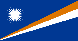
Marshall Islands
Republic of the Marshall Islands
Population: UN WPP 2024, revision 1, projection for 1 July 2026. Sources and methodology.
Geography and territory
The Republic of the Marshall Islands is a remote nation in the central Pacific Ocean, made up of 29 coral atolls and five standalone islands arranged into two parallel chains: Ratak, the “sunrise” chain, to the east, and Ralik, the “sunset” chain, to the west. Its total land area amounts to just 181 km², yet these scattered fragments of coral are spread across more than two million square kilometers of ocean, giving the country one of the largest exclusive economic zones relative to land area of any nation on Earth.
The atolls themselves are extraordinarily fragile coral formations, with an average elevation of only about two meters above sea level. The country’s highest point reaches a mere 10 meters, making the Marshall Islands one of the lowest-lying nations on the planet and among the most vulnerable to climate change and rising seas. Kwajalein Atoll contains the largest atoll lagoon in the world, covering roughly 2,174 km² of sheltered water.
What the Marshall Islands lacks in land it makes up for many times over in ocean. The clear waters surrounding the atolls support well-preserved coral reefs rich with tropical fish, reef sharks, sea turtles, dolphins, and manta rays. Inside each atoll, calm turquoise lagoons offer a striking contrast to the open Pacific swells that pound the outer shores, and the country’s tiny population of 36,282 lives almost entirely within reach of this surrounding sea.
History
The Marshall Islands were settled roughly 2,000 years ago by Micronesian navigators arriving from Southeast Asia. These early inhabitants developed an exceptional seafaring tradition, creating stick charts made from wood and shells that mapped ocean swell patterns rather than landmasses. These abstract navigational tools, unique in the world, allowed Marshallese sailors to cross hundreds of kilometers of open ocean with remarkable precision, without any of the instruments used elsewhere.
Spanish explorer Álvaro de Saavedra sighted the islands in 1529, and British captain John Marshall charted the chain in 1788, lending it his name. Germany established a protectorate in 1885, followed by Japanese occupation during the First World War. The Second World War brought intense fighting to the islands, and the 1944 Battle of Kwajalein ranks as one of the most successful American amphibious operations of the entire conflict.
The darkest chapter of Marshallese history is the era of American nuclear testing. Between 1946 and 1958, the United States detonated 67 nuclear devices at Bikini and Enewetak atolls, including the 1954 Castle Bravo test, the most powerful nuclear weapon the United States has ever detonated, at 15 megatons. The people of Bikini were evacuated and have never been able to return permanently, and the medical and environmental consequences of the testing program continue to affect Marshallese communities today. Independence arrived on October 21, 1986, through a Compact of Free Association with the United States.
Culture and society
Marshallese culture is deeply oceanic, rooted in the navigational knowledge that allowed ancestors to settle and thrive on tiny, scattered coral atolls across the vast Pacific. The traditional stick charts, known as mattang, wappepe, and rebbelib, remain the most recognizable symbol of this maritime heritage and represent a remarkably sophisticated indigenous scientific system for reading ocean swells.
Marshallese society is organized around matrilineal clans, with land and traditional rights passed down through the maternal line. The iroij, or traditional chief, continues to hold an important role in community affairs, particularly matters concerning land and custom. The Marshallese language splits into two main dialects, Ratak and Ralik, corresponding to the two island chains. Storytelling, chant, and song preserve oral history, genealogy, and navigational knowledge across generations.
Traditional crafts include weaving mats and baskets from pandanus and coconut fiber, making flower garlands, and building models of traditional canoes. Communal dance and song accompany celebrations, with choreography recounting creation myths, sea voyages, and historical events. American influence is unmistakable in modern daily life, visible in the popularity of basketball and baseball as well as in diet and the more urban lifestyle found in Majuro.
Economy
With a gross domestic product of roughly $308 million, the Marshallese economy relies heavily on financial transfers from the United States under the Compact of Free Association. These funds, supplemented by assistance from other nations and international organizations, finance the bulk of public spending and government services, and the government itself remains the country’s largest employer.
Fishing, particularly for tuna, is the most important natural economic resource. Fishing licenses sold to foreign fleets and tuna processing operations based in Majuro generate significant revenue. The American military installation on Kwajalein Atoll, used for ballistic missile testing and space tracking, provides substantial annual lease payments and employs hundreds of Marshallese workers.
The Marshall Islands shipping registry has grown into the second-largest in the world, rivaling Panama and Liberia as a flag of choice for oil tankers, bulk carriers, and container ships. This registry generates meaningful income through registration fees and related services. Copra remains the only significant agricultural export. Tourism, though limited by remoteness and modest infrastructure, draws divers interested in Second World War shipwrecks and the country’s pristine atolls. As a presidential republic with its own elected government, the Marshall Islands manages its domestic and foreign affairs independently even while relying on its close financial and defense relationship with the United States.
Food and cuisine
Marshallese cuisine is fundamentally an atoll cuisine, shaped by the limited resources of narrow strips of coral land and the abundance of the surrounding ocean. Fresh fish forms the dietary foundation, prepared grilled over coconut-husk coals, simmered in coconut milk, sun-dried for preservation, or eaten raw in preparations reminiscent of Japanese sashimi. Tuna, wahoo, flying fish, and various reef species are the most commonly eaten catches.
Coconut is the most versatile food resource in the islands. Its flesh is eaten fresh, grated, or dried into copra; its milk forms the base for stews and soups; its water serves as the everyday refreshing drink; and its fermented sap produces jekaru, a coconut toddy that can be sweet or alcoholic depending on how long it ferments. Pandanus, whose fruit is processed into a dense, sweet paste called mokwan, is another staple that can be stored for months at a time.
Breadfruit is commonly roasted, boiled, or mashed into a thick paste. Taro, though scarcer here than on other Pacific islands because of the poor coral soil, is grown in pits dug into the atoll surface. The modern diet has absorbed a considerable amount of imported food, including rice, noodles, canned meat, and soft drinks, a shift that has contributed to rising rates of diabetes and obesity. Communal feasts for major celebrations typically feature pork, chicken, and a range of fish and shellfish dishes served on banana leaves.
Tourism and landmarks
The Marshall Islands offers a remote, authentic style of travel for visitors willing to reach one of the most isolated corners of the Pacific. Bikini Atoll, site of the American nuclear tests, is now a UNESCO World Heritage Site and draws divers eager to explore the ships and aircraft deliberately sunk during the testing program, including the aircraft carrier USS Saratoga and the Japanese battleship Nagato, both resting at accessible depths.
Majuro Atoll, home to the capital, offers a striking contrast between modern Marshallese life and enduring cultural tradition. The Alele Museum preserves historical artifacts, traditional stick charts, and documentation of the nuclear testing era. Majuro’s lagoon provides opportunities for snorkeling, kayaking, and sport fishing. The outer islands of Arno, Mili, and Jaluit offer a more traditional experience, with village life, untouched beaches, and pristine reefs far from any tourist infrastructure.
Kwajalein Atoll, though partly restricted due to the American military presence, holds the largest atoll lagoon in the world along with Second World War wrecks beneath its waters. Enewetak and Rongelap atolls, both affected by nuclear testing, stand as sobering reminders of the atomic age. For travelers drawn to history and nature alike, the Marshall Islands offers a rare chance to explore coral atolls in nearly pristine condition, their reefs still teeming with marine life.
Fun facts about Marshall Islands
- Traditional Marshallese stick charts are the only known indigenous system of oceanic cartography that mapped wave and swell patterns instead of landmasses, enabling precise navigation without instruments.
- Bikini Atoll lent its name to the modern bikini swimsuit: designer Louis Réard named his two-piece design in 1946, comparing its impact to the nuclear tests that had just taken place there.
- The Marshall Islands operates the world’s second-largest ship registry, with thousands of merchant vessels sailing under its flag across every ocean.
- The 1954 Castle Bravo nuclear test at Bikini Atoll was roughly a thousand times more powerful than the bomb dropped on Hiroshima, and its radioactive fallout contaminated an area exceeding 18,000 km².
- Kwajalein Atoll contains the largest atoll lagoon on Earth, spacious enough that the entire land area of the Marshall Islands could fit inside it.
- With only 36,282 people spread across 181 km² of land amid two million square kilometers of ocean, the Marshall Islands is one of the most sparsely populated and geographically scattered nations in the world.
The Marshall Islands in numbers
Latest World Bank and UNDP observations, each with its own year. “World median” is the middle value among the countries that report the same indicator; “#” ranks from the highest value.
Population since 1960
The Marshall Islands had 14,703 people in 1960 and 36,282 in 2025 — 2.5 times as many.
The population peaked at 52,044 in 2010 and has since declined.
People
79.1% of people live in towns and cities (world median 63.4%). 33.9% are under 15 and 4.9% are 65 or older — a young population. Women have 2.86 children on average, above the replacement level of about 2.1.
Economy
The economy grew by 2.3% in real terms in 2025. Services make up the largest share of output (68.2% of GDP); agriculture contributes 19.9%.
Development and environment
UNDP rates human development in the Marshall Islands as high, with an index of 0.733 in 2023 (rank 108 of 193). 65.9% of people use the internet and 97.2% have access to electricity. Forest covers 53.6% of the land (world median 32.8%).
Sources: World Bank, World Development Indicators (CC BY 4.0), most recent observation from 2015 onward; UNDP Human Development Report 2025. Retrieved 2026-10-10. Sector shares need not add up to 100% because taxes and subsidies on products are excluded. Missing values are left blank rather than estimated. Sources and methodology.
Climate of the Marshall Islands
Averaged across the Marshall Islands, the mean temperature stays between 27.7 °C (January) and 28.2 °C (June) — a swing of only 0.5 °C, so seasons are marked by rainfall rather than by heat.
About 2,670 mm of precipitation falls in a typical year. October is the wettest month (285 mm) and March the driest (156 mm).
Show monthly values as a table
| Month | Mean °C | Low °C | High °C | Precipitation, mm |
|---|---|---|---|---|
| January | 27.7 | 25.5 | 30.0 | 170 |
| February | 27.8 | 25.5 | 30.2 | 158 |
| March | 27.9 | 25.5 | 30.3 | 156 |
| April | 28.0 | 25.6 | 30.5 | 209 |
| May | 28.1 | 25.7 | 30.6 | 219 |
| June | 28.2 | 25.6 | 30.8 | 218 |
| July | 28.2 | 25.7 | 30.8 | 243 |
| August | 28.2 | 25.5 | 30.9 | 255 |
| September | 28.2 | 25.5 | 31.0 | 267 |
| October | 28.2 | 25.6 | 30.9 | 285 |
| November | 28.1 | 25.7 | 30.7 | 265 |
| December | 27.9 | 25.7 | 30.2 | 227 |
Figures are 1991–2020 averages across the whole land area of the Marshall Islands, from the World Bank Climate Change Knowledge Portal, CRU TS 4.08 (CC BY 4.0). They are not readings from one weather station: the capital, the coast and high ground can be much warmer, cooler, wetter or drier.
Travel essentials for the Marshall Islands
The practical details visitors ask about first. Traffic in the Marshall Islands drives on the right, like most of the world. Mains electricity is 120 V at 60 Hz, so appliances built only for 220–240 V need a voltage converter.
- Emergency number
- 911
- Driving side
- Right
- Plug types
- Type A, Type BA: two flat parallel pins; B: two flat pins plus a round earth pin
- Voltage
- 120 V60 Hz
- Dialling code
- +692From abroad: your exit code, then 692 and the number
- Currency
- United States Dollar (USD)
- Time zone
- MHT (UTC+12)Current local time in the Marshall Islands
Compiled from IEC plug and voltage standards, national emergency-service listings and the UN road-traffic conventions. Emergency numbers and local coverage can change — confirm them locally on arrival. The Marshall Islands's internet domain is .mh.
Where the Marshall Islands ranks in the world
Each position counts only the countries with data in that ranking guide. First place is the highest value — for price levels, the most expensive. Select a card to see the full table.
- Population191st of 19635,075UN projection, July 2026
- Land area189th of 195180 km²World Bank, 2023
- Population density49th of 194216 per km²World Bank, 2023
- GDP (nominal)185th of 187$285MWorld Bank, 2024, current US$
- GDP per capita92nd of 187$7,590World Bank, 2024, current US$
- Life expectancy155th of 19467.1 yearsWorld Bank, 2024
Compare the Marshall Islands with another country
Frequently asked questions about the Marshall Islands
What is the capital of the Marshall Islands?
The capital of the Marshall Islands is Majuro.
What is the population of the Marshall Islands?
The UN World Population Prospects projection for the Marshall Islands is 35,075 people (35,075) on 1 July 2026. National statistical offices may publish different estimates.
What language is spoken in the Marshall Islands?
The official language of the Marshall Islands is Marshallese, English.
What currency is used in the Marshall Islands?
The currency of the Marshall Islands is the United States Dollar (USD).
How big is the Marshall Islands?
The Marshall Islands covers an area of 181 km².
What type of government does the Marshall Islands have?
The Marshall Islands is a presidential republic.
What is the highest point in the Marshall Islands?
The highest point in the Marshall Islands is Unnamed point on Likiep (10 m).


